BIM & GIS - Technology that is Revolutionising the AEC Industry and how!
Technological advancements are redefining and reshaping many sectors today. The AEC industry is keeping up with time. Architectural design tools are taking design representation and visualisation to new heights. With the explorations in augmented and virtual reality, many tools are being developed to aid in communicating spatial complexities to clients without the need to be physically present at the project location. With Artificial Intelligence being the new buzzword in every room, the design fraternity could not be left behind. AI has not only revolutionised data analysis in the field but also helped in the development of many tools, softwares and platforms that aid designers and construction professionals everyday. On a larger scale, drone technology has allowed urban designers and planners to capture, collect data and receive regular progress updates on massive sites.
But two such tools have already made it big and are almost an inherent part of architectural design and town planning offices today. The arrival of BIM (Building Information Modelling) and GIS (Geographic Information System) has reduced the margins of error and is helping architects and designers simulate various possibilities of the design, create digital twins of buildings, and analyse large geographical data sets. This blog looks at the benefits that BIM and GIS technologies bring to the AEC industry along with the challenges of implementing the same into the practice.
Benefits of BIM & GIS in Architecture & Design
Building information modelling, colloquially called BIM, uses different tools and technologies to manage and generate digital representations of buildings, sites and systems. Akin to BIM, Geographic Information System or GIS is a combination of hardware and software that helps visualise geographic data that helps in large-scale design and planning projects. The presence and continuous technological sophistication being brought by BIM and GIS is moving to potentially change the manner in which the AEC industry functions. The two tools are catalysing a revolution in the field of architectural representation.
BIM and GIS have inherently helped architects with better communication, improved day-to-day project coordination and boosted the decision-making process. Moreover, integrating the two has enhanced research and analysis for projects with the help of simulated three-dimensional scenarios that show the impact building structures have on the surrounding environment and vis-a-vis. The multidisciplinary nature of architectural and design practice calls for efficient coordination. When used in unison, BIM and GIS help the workflow function more effectively while reducing the chances of delays and errors.
Challenges in Adoption and Putting It Into Practice
Being relatively new compared to the available tools used for digital architectural representation, BIM and GIS come with their set of challenges when it comes to wider adaptability. The arrival of new technology requires training, even if it is basic know-how that does the job. Since BIM and GIS need advanced software training, trained resources are not readily available. Using softwares supported by these two technologies is difficult for non-technical personnel as it takes them a while to get used to these tools. Additionally, many professionals aren’t adept at and, sometimes, aware of the latest developments in the field. Therefore, they tend to prefer the traditional tools of design, which has become a drawback in adopting these tools.
Tools like BIM and GIS need diverse decisions to be made upfront; thus, the initial time required to set up the project is higher. Sometimes this may challenge the client’s expected timelines. Moreover, these tools require a considerable initial investment, which might challenge smaller architectural offices. Even training employees in the same ends up being a costly affair.
Using BIM & GIS for Large-Scale Projects
Urban planning and design projects require dealing with a relatively larger area than architectural sites. GIS and other spatial tools lend a greater advantage in master planning projects as they allow for the visualisation and analysis of complex spatial data over a large area. For instance, in our project East Delhi Hub, a smart transit-oriented development designed in association with IDOM Spain, we used GIS and allied spatial tools to collate data that assisted us with transportation analysis. It helped us understand the spatial context by simulating various maps, which further helped us conceptualise the ideal planning strategy. Approaching city planning with Geo-Design also ensures the inclusion of sustainability, livability and resilience in our urban environments.

East Delhi Hub, Designed in association with IDOM Spain
Spatial analysis from such tools can prove to be vital in designing transport facilities. For our projects, we analyse the passenger flow, which involves the avoidance of bottlenecks or points of congestion. While designing the metro/railways, these tools help us understand how various railway routes intersect, the frequency at which the trains pass by, and the footfall during peak hours.
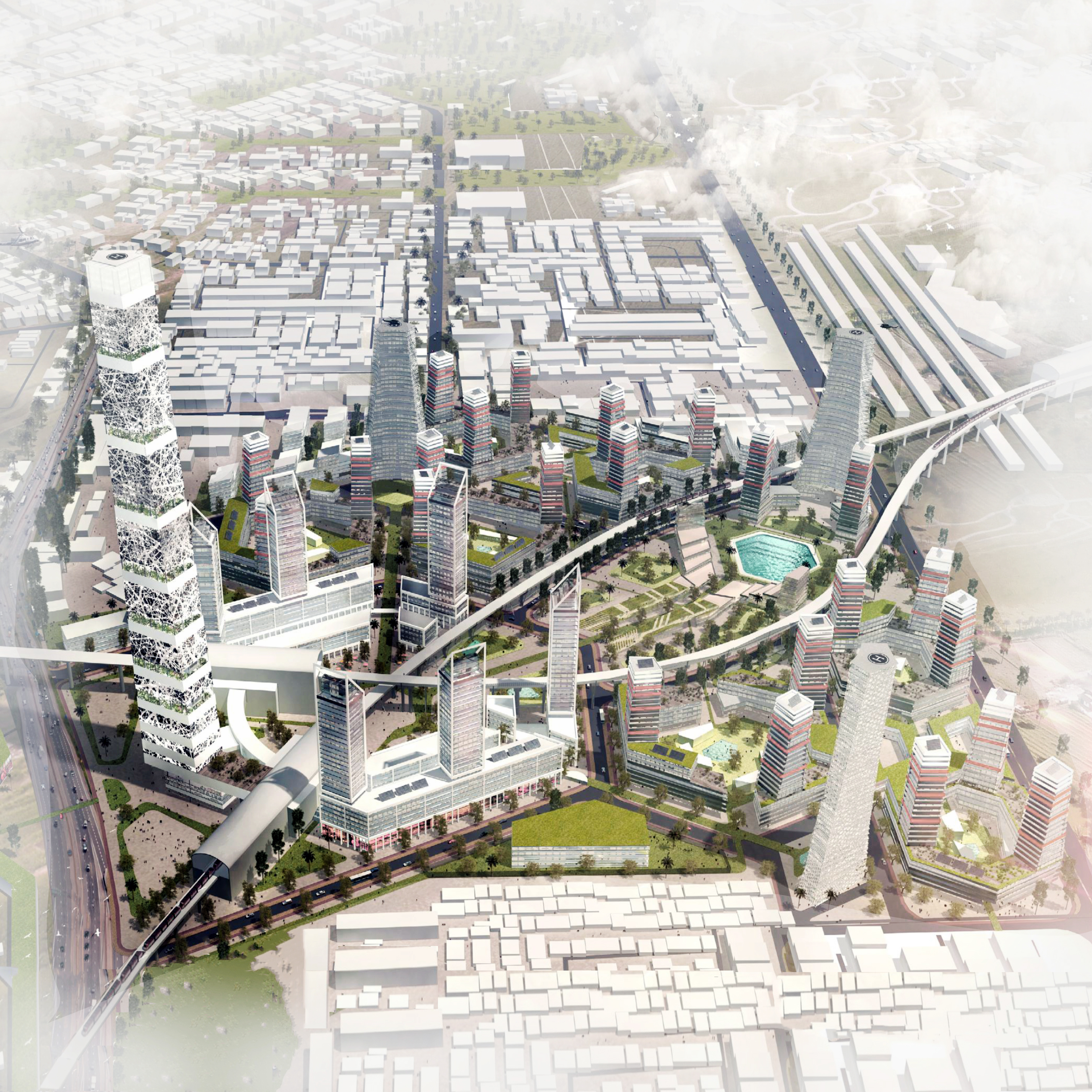
East Delhi Hub, Designed in association with IDOM Spain
With their manifold benefits, tools like BIM and GIS are trickling into common practice. This digital revolution is seeing the light of day as architects, designers, and planners are starting to use BIM and GIS to visualise, analyse and communicate intricate spatial data to make better design decisions.


